To see what I'm talking about, take a look at http://wardmap.theballfamily.org/intro.asp.
I'm willing to share my code base with folks on the LDS.org team if it might help. Thanks!
Great Idea
We struggled with creating a usable church map for emergency preparedness. This included several techies as well.lincles wrote:This is one of the better idea's i've seen in a long time. This would increase the usability of the member list in the ward website by a lot. I put my ward in and was impressed how well it worked. It was cool to get a feel for where every one lived.
Some ideas how else it could be used in combination with the ward websites:
I log into the ward site, click on a member, and get driving directions from my house to the members house. - This would especially be helpful for wards that are spread out.
Be able to create custom groups of members. For example, the Teachers Quorum Advisor could create a group for each fast offering route and print a map for each member of the quorum.
Lots of possibilities here - very good Idea
-Lincoln
Question for Tom
We are having discussions internally today about this issue and I'll post more when I know more.Aaron wrote:I know these forums aren't for church policy -- I just want to make sure I understand something. With these mapping tools, we're submitting ward membership data to an external (albeit apparently secure) server. Is this basically one of those cases of "if the Bishop says it's okay, then we can use it" kind of resources, pending any formal policy guidelines from Church Offices?
Thanks,
Aaron
Application removed
Thanks! We appreciate your support. Your innovation and implementation of this idea is excellent!kevandcan wrote:Just a quick follow-up note that the application and all associated data have been removed from the ward map server. Thanks, and I look forward to hearing from you.
Doesn't do it justice, but here's an image of the interactive ward maps:RussellHltn wrote:For the benefit of those of us who didn't look at it when it was up, would it be possible for us to see it using dummy data? I'm not sure how hard it would be to dummy something up.


Thanks, that helps.kevandcan wrote:Doesn't do it justice, but here's an image of the interactive ward maps:
I think a copy of that post should be put in the announcements section under something like "Church Policy". No doubt this issue will come up again on this forum and in others and it would be best to have a copy in a place that's easily findable.tomw wrote:It was decided within these meetings that we respectfully ask you not to upload your ward files to this web site for the following reason.
lincles wrote:Just some thoughts -
First of all I think this thread is exactly why this will be a great site. A member had an excellent idea, shared it on the forum, discussed, then the church IT saw the benefit and decided to look into the possibility of adopting the code. I hope everything works out and that the feature can be implemented on the unit sites.
If for whatever reason it doesn't get implemented what about a locally installed version of the tool - something that unit leaders could install on their own machine and then draw from a local list. This way the member lists would not need to be aggregated in a central location. I really think integration into the unit sites would be ideal, but this is just another option in case it doesn't work out.
Let me know if there is any way I can help out. I have web programming experience in several languages and would be happy to help any way I can.
Thanks again for this great forum
-Lincoln
That is why we have these forums. I'm very excited about the innovation that the community is already doing. Some ideas we will pick up at a Church level and some are best implemented by the community but in the end it benefits more people.lincles wrote:Just some thoughts -
First of all I think this thread is exactly why this will be a great site. A member had an excellent idea, shared it on the forum, discussed, then the church IT saw the benefit and decided to look into the possibility of adopting the code. I hope everything works out and that the feature can be implemented on the unit sites.
If for whatever reason it doesn't get implemented what about a locally installed version of the tool - something that unit leaders could install on their own machine and then draw from a local list. This way the member lists would not need to be aggregated in a central location. I really think integration into the unit sites would be ideal, but this is just another option in case it doesn't work out.
Let me know if there is any way I can help out. I have web programming experience in several languages and would be happy to help any way I can.
Thanks again for this great forum
-Lincoln
Suggestion: Integration of several ideas?
Relative vs. Absolute URL's to Forum Threads
Read here on how to link to threads and posts. These links will be relative.mkmurray wrote:Tom,
I just tried to edit kgthunder's link to another thread by making it a relative link rather than an absolute one (we aren't going to be in beta forever, and thus the beta.tech.lds.org would break the link when we go live). However, it appends http:// to the front of whatever I type in. Perhaps you can show me how it is done? Thanks. :rolleyes:
kgthunder wrote:Thanks mkmurray for the update and tomw for the link - am I missing the link to this in the normal navigation, or is it buried several layers deep? Could it be moved to a more conspicuous location for easy reference?
The other way to find it is to look at the bottom of the page (while viewing or writing a post) and you will see a box that says "Posting Rules". In this box you will see a link called "vB Code" which links you to all of the legitimate vBulletin markup codes you can use and how to use them.kgthunder wrote:Thanks mkmurray for the update and tomw for the link - am I missing the link to this in the normal navigation, or is it buried several layers deep? Could it be moved to a more conspicuous location for easy reference?
In our ward, we did something very similar, but used Google Earth to avoid some of the privacy issues mentioned in this thread. It offers very similar functionality to Google Maps, but not online, so that access to the data can be restricted to those who should have it.tomw wrote:What Kevin has done with his site is very cool. We would like to add this functionality to the LUWS and because of Kevin's great work, we are organizing a team to understand if and how quickly we could add this type of capability to our site. We have asked for Kevin's help since he was the original author of the code.
Boundary Changes
Overlay of shape files on mashups?
lincles wrote:Just some thoughts -
First of all I think this thread is exactly why this will be a great site. A member had an excellent idea, shared it on the forum, discussed, then the church IT saw the benefit and decided to look into the possibility of adopting the code. I hope everything works out and that the feature can be implemented on the unit sites.
If for whatever reason it doesn't get implemented what about a locally installed version of the tool - something that unit leaders could install on their own machine and then draw from a local list. This way the member lists would not need to be aggregated in a central location. I really think integration into the unit sites would be ideal, but this is just another option in case it doesn't work out.
Let me know if there is any way I can help out. I have web programming experience in several languages and would be happy to help any way I can.
Thanks again for this great forum
-Lincoln
kevandcan wrote:I've continued to receive a LOT of feedback from folks wanting access to the WardMap I had hosted. I've explained to them I can't, due to the reasons posted earlier in this thread. As such, I created a VBS file that anyone can run on their Windows machine and consume their Ward Member CSV file from LDS.org. It solves the 2 issues posted by Tom and lets folks still have a ward map quickly and easily...without sharing your ward data with anyone.
http://wardmap.theballfamily.org
Thanks,
Kevin
Kevin...kevandcan wrote:I've continued to receive a LOT of feedback from folks wanting access to the WardMap I had hosted. I've explained to them I can't, due to the reasons posted earlier in this thread. As such, I created a VBS file that anyone can run on their Windows machine and consume their Ward Member CSV file from LDS.org. It solves the 2 issues posted by Tom and lets folks still have a ward map quickly and easily...without sharing your ward data with anyone.
http://wardmap.theballfamily.org
Thanks,
Kevin
pulliae wrote:Kevin...
I was just curious...but...how do you know that yahoo does not keep the names/addresses/phone #'s that you send to create the markers on their map...???
wouldn't that be a security problem if they saved them...i know it doesn't pass anything about being church members...and you could be passing anyones names...but just wanted to make sure...
i haven't looked into it at all yet...no time...but i have a few other questions...
1. can you color code the markers...? blue for ym, green for yw, etc..
2. do you have any instructions on the api?
3. i assume this is your id? do we need our own id's?
"http://maps.yahooapis.com/v3.0/fl/javas ... arkwayward"
4. can we make a different marker for the church building?
5. did they tell you when they were going to implement something like this for the local wards on lds.org
in other words...am i supposed to wait patiently (talks on Sunday) or start playing with this api ?
Thanks...
Edward
gis and ward maps.
K.I.S.S....my motto!
Yes, that should be fine.phxdwl wrote:is it ok to use the data, as long as the data is geocoded with localy loaded datasets, and localy loladt loaded gis tools.
Geocoding is Complex for Rural Wards
This is good work and a step in the right direction
There is spell check capability on these forums. In fact it is in the upper right corner when you are drafting your post. However, it requires a free download called ieSpell, which is an IE plugin. The nice thing is that you can use the spell checker on more than just this site, but it integrates nicely with these forums.Last edited by Mr. Techno : Today at 09:04 PM. Reason: Spelling error. A spell checker would be a good tool to add to this site.
For USA geo info, how about the USPS?
The [thread=241]ward mission program[/thread] I've been working on could benefit from this type of technology. Currently I don't keep a lot of information about members in the program as the program tracks information about families and individuals that are being taught but as this program expands, I could see a technology like this being added to help plan splits and dinner appointments for missionaries. It could even help the missionaries decide the most efficient way to use the miles on their cars by allowing the ward mission leader to help them plan a route that they will work during the week.kgcrowther wrote: However, I was able to do some interesting things for our ward missionaries. For example, I overlayed the membership map on top of a population density raster and calculated population - to - membership density ratios. This highlights the areas that are high in population, but low in membership for potential tracking. Other maps can be used when seeking certain talent for the ward (which is needed in rural wards), or to see if we are not properly taking care of new members that are located in far reaching locations. Such information with faith and the Spirit can powerfully inform decisions.

kgcrowther wrote:I live in a ward in the rural part of VA that is almost the size of the state of Rhode Island, and have felt that mapping would provide great value to organize ward missionary work through helping the missionaries with rides, referrals, and member visits. I am fortunate to have access to ESRI ArcGIS and sophisticated geocoding packages provided by ESRI and other geography giants through my appointment at the University of Virginia. (I believe ESRI ArcGIS can provide web services across a variety of enterprise architectures, although I imagine that the software is expensive .) However, I was surprised by the low rate success in my geocoding effort. I even tried some other web mapping service (similar to Kevin), such as Yahoo, Microsoft, and Google with even less success. The problem was that many of the addresses in the ward roster are ... "Box 1 Rural Route 3" or "555 Deer Farm Road"... Rural routes and farm roads do not exist in large-scale street files that are maintained for web mapping. (however, I must note that Google Earth was able to find quite a few - and must use a different map set or geocoding algorithm than their online mapping service.)
However, I was able to do some interesting things for our ward missionaries. For example, I overlayed the membership map on top of a population density raster and calculated population - to - membership density ratios. This highlights the areas that are high in population, but low in membership for potential tracking. Other maps can be used when seeking certain talent for the ward (which is needed in rural wards), or to see if we are not properly taking care of new members that are located in far reaching locations. Such information with faith and the Spirit can powerfully inform decisions.
Geography is an important tool in making these decisions. I would recommend that the church investigate both commercial and open source options, while investigating what features to implement and how to do it to best meet the objectives of the church. However, I would recommend that if possible and feasible that the church team host geocoding web services internally - and NOT rely on the APIs or street maps of any particular existing web service.
"geocoding" using Google Earth
I have found that home teachers, visiting teachers, and full time missionaries can locate addresses on a map. There is a information bar at the bottom of Google Earth that report lat./long. coordinates. I have found that I can ask members to find the address on a Google Earth and just tell me what the lat./long. reading is. This has been an effective way to "geocode" the addresses that none of the geocoding services (YahooMaps and ESRI included) are able to properly code.JTaber wrote:Part of the problem there is that ESRI no longer puts the latest Census TIGER maps (in shapefile form) on its site. They do bundle (starting with 9.2) map data from TeleAtlas with ArcGIS. So for now I'm using that to match most of the stake (slightly larger than Connecticut, covering almost all of Delaware, half the landmass of Maryland, and one school district in Pennsylvania.) I match three units a week that way, and then once in a while try to manually match addresses that fell through the cracks, against YahooMaps (which I've found is most reliable of the online services.)
I think population data is available on the census block level.JTaber wrote:In the past, I've based things more on census tracts and tried to see where our strengths are compared to population. But in many cases ward boundaries don't respect census tracts, and in Delaware neither do school districts. (At least they do in Maryland and Pennsylvania.) So for me, that's on the shelf for right now, but there would be great potential for someone at a higher level to maintain that sort of data.
I think eventually lat./long. should just be entered into MLS as another field in the database. This would be relatively simple and avoid the need to geocode over and over again.JTaber wrote:Like I said before, I've had to play around with data sources to find something I can use easily. It's only because of what I have access to right now at work that things are going so efficiently that I can re-geocode all thirteen units in my stake each month. Personally, I feel that (and not just in the United States or other countries with similar levels of street data) the Church should generate latitude and longitude (or some equivalent) for each and every address. (Each ward and branch is supposed to have a physical address for each family as it is.)
I agree.JTaber wrote: Once automated, it wouldn't be that difficult to implement or maintain.
kgcrowther wrote:I think population data is available on the census block level.
I think eventually lat./long. should just be entered into MLS as another field in the database. This would be relatively simple and avoid the need to geocode over and over again.
kevandcan wrote:I've continued to receive a LOT of feedback from folks wanting access to the WardMap I had hosted. I've explained to them I can't, due to the reasons posted earlier in this thread. As such, I created a VBS file that anyone can run on their Windows machine and consume their Ward Member CSV file from LDS.org. It solves the 2 issues posted by Tom and lets folks still have a ward map quickly and easily...without sharing your ward data with anyone.
http://wardmap.theballfamily.org
Thanks,
Kevin
other uses for WardMap.vbs?
Keep in mind that the the closest meetinghouse may not be the ward whose boundaries you live in. What you propose is fine for travelers, but could create problems for new move-ins.opee wrote:The ward maps functionality would also be nice on the Meetinghouse Locator function--to be able to see where the nearest ward is to a location you are at.
It is still a work in progress. No new news.On_Target_Advocate wrote:What is the latest status on getting this (or something like it) available in LUWS?
tomw wrote:It is still a work in progress. No new news.
Tom
Wish Kevin's VBS app would work for me.
kevandcan wrote:I've continued to receive a LOT of feedback from folks wanting access to the WardMap I had hosted. I've explained to them I can't, due to the reasons posted earlier in this thread. As such, I created a VBS file that anyone can run on their Windows machine and consume their Ward Member CSV file from LDS.org. It solves the 2 issues posted by Tom and lets folks still have a ward map quickly and easily...without sharing your ward data with anyone.
http://wardmap.theballfamily.org
Thanks,
Kevin
srweight wrote:Kevin, et al, this sounds like a wonderful program, but when I run it I get a error message. I will try to attach a jpg file of the error message - not sure that it will work. Any help would be great!
Works in vista
I was able to get it to run in Vista by commenting out the lines requested, then running it from a command prompt that is set to "run as administrator". You still get some security warnings from IE, but it works. You need to be in the directory with the script and type "wscript WardMap.vbs".bkh8 wrote:Has anyone been able to get this program to work on Windows Vista? I have tried to comment out the spots that Kevin says to in non xp computers, but i still get error reports. I have very little programming experience so any help would be great. Thanks
What's Going On With It Now?
Yes, there has been for some time. But you must only run the "local" version of the script. It is ok to export data from MLS and run it through a utility you trust locally on your own machine or a ward computer. The problem was when this was being hosted on a web server that was not a church-hosted server.SR Ward Clerk wrote:So is there a working version of this utility yet that is authorized for use?
So you have the VBScript file and your MLS membership export CSV file?SR Ward Clerk wrote:I have to admit that I don't know how to install the feature. I downloaded both files as instructed, but I don't know what to do to make it function.
Ward map not populating
mtolman wrote:Wow has Kevin ever hit a need nerve !!
I downloaded the files as instructed, am running XP, have my ward directory etc. But when the app starts I get what looks like the correct application but no map etc. I simply have a nice pale blue screen with his title page at the top and the instruction bar on the left, but no map in the right (main panel).
Is there an underlying app that may have been stripped off my corporate machine?
Troubleshooting
opee wrote:When I first tried to get it to run, I had the same error, and I seem to remember that the permissions were not set correctly in the Adobe software. You also have to make sure that you allow the ActiveX plugin to run. Hope this helps.
But is this really an approved method?
As I understand the pollicy, we are not allowed to send our membership data to any outside company. This would include Google, Yahoo, etc.mkmurray wrote:Yes, there has been for some time. But you must only run the "local" version of the script. It is ok to export data from MLS and run it through a utility you trust locally on your own machine or a ward computer. The problem was when this was being hosted on a web server that was not a church-hosted server.
Not exactly; read the entirety of this thread and you will see a discussion about this issue. The conclusion was that the addresses or coordinates are being sent to Yahoo, but not any other member information. An address really means nothing if there is no member name (or similar information) associated with it. There is nothing on Yahoo's side to identifiy it as member information, it's just a bunch of addresses to them. Also if the information was sniffed on it's way to Yahoo, there's still nothing to signify it is member addresses. The other conclusion was that it is likely Yahoo doesn't store the locations on their servers anyway. If somebody does find a statement to the contrary, please post it here for all to discuss.mwallred wrote:It looks to me like the standalone script still calls upon Yahoo maps to get the mapping data. It sends all of the membership data to them in order to generate the map.
Either in this thread or another thread on this forum, somebody talked about using Google Earth in this way. I think it's a great idea, I just don't remember if anyone actually made something or not. I don't think Google sends the data up, I think it is done locally. Again, someone correct me if you find the opposite out there.mwallred wrote:Is anyone out there using any commercial mapping software to generate ward membership maps using only the local PC? That's how Google Earth works, right? Or do they also require data to be send up to the big Google server farm?
Local mapping data vs online data
Actually, I did read the entire thread, including the policy statement that was issued. I'm no script expert so I didn't attempt to analyze the whole thing to see what it was sending. I just assumed that in order for Yahoo to put the identifying information (e.g. member name) on the pin flag or into any popup windows on the map that it would need to have that data sent to it. It didn't seem real logical to think that the client side would be handling that part of it.mkmurray wrote:Not exactly; read the entirety of this thread and you will see a discussion about this issue. The conclusion was that the addresses or coordinates are being sent to Yahoo, but not any other member information. An address really means nothing if there is no member name (or similar information) associated with it. There is nothing on Yahoo's side to identifiy it as member information, it's just a bunch of addresses to them. Also if the information was sniffed on it's way to Yahoo, there's still nothing to signify it is member addresses. The other conclusion was that it is likely Yahoo doesn't store the locations on their servers anyway. If somebody does find a statement to the contrary, please post it here for all to discuss.
That's what I thought about Google Earth- you don't even need an internet connection once you download all the map data for your area, so you can put pins all over the map without any data getting back to Google. Software like Streets and Trips and maybe even some of the Nav system packages could do it as well while keeping all the data local.mkmurray wrote: Either in this thread or another thread on this forum, somebody talked about using Google Earth in this way. I think it's a great idea, I just don't remember if anyone actually made something or not. I don't think Google sends the data up, I think it is done locally. Again, someone correct me if you find the opposite out there.
Point well taken.mwallred wrote:Actually, I did read the entire thread, including the policy statement that was issued. I'm no script expert so I didn't attempt to analyze the whole thing to see what it was sending. I just assumed that in order for Yahoo to put the identifying information (e.g. member name) on the pin flag or into any popup windows on the map that it would need to have that data sent to it. It didn't seem real logical to think that the client side would be handling that part of it.
Also, the fact that it isn't likely that Yahoo doesn't store the data is irrelevant. IIRC, the policy stated that we couldn't send member data to another server, or maybe just ones that could be storing it. Do we need to check Yahoo's policy page every time before we use their mapping service this way? Storage keeps getting cheaper and the desire for data higher.
Does anybody remember when Google was inadvertently releasing all kinds of private data due to a bug on their system? Do we want that to happen to us? I'd rather err on the side of caution.
Sometimes silence speaks volumesmkmurray wrote:Point well taken.
Tom, because of the silence from Church employees when the discussion was had, the community decided this VB script solution was secure enough to align with the posted policy. Should the security of this solution be revisited, with Church input this time?
mkmurray wrote:So you have the VBScript file and your MLS membership export CSV file?
All you should have to do if you're running on XP is double-click the VBS file. There isn't any installation of a program. Are you getting an kind of error? Are your running an OS other than XP?
When I went to his site, there were instructions on what to do if you are not on XP or if you have Adobe Flash errors.
Right-click on the vbs file and choose "Open With". You'll want to open it with an editor (Notepad is easy), but only this time, so if you get the dialog box that says "Always use this program to open this type of file", don't select the checkbox (otherwise, I don't think you will be able to double-click it anymore).SR Ward Clerk wrote:Now my question is, Is there a way to zoom in on the map or, better yet, make the map larger so it is easier to see where there are names blocking other names?
Code:
tsHTM.WriteLine "<script type=""text/javascript"">"
tsHTM.WriteLine " // Create and display Map object at the address and with zoom level 3 "
tsHTM.WriteLine " // Include your application ID."
tsHTM.WriteLine " var map = new Map(""mapContainer"", ""parkwayward"", """ & pMapCenterAddress & """, 3); "Mowen, take a look at this thread. I built an alternative to this map-maker - uses google instead of yahoo (works better outside america) and has settings for both MLS and LUWS membership downloads. It also has filtering and some other options. The resulting file can be viewed in Google Earth.Mowen wrote:Hi all,
Like most LDS church members I live outside the USA.
This script seems to require data exported from the (still North America only) Stake and Ward websites.
More widely available to church members is the church's MLS software, from which I can export data.
I'd like to build a converter from MLS format to "Stake and Ward websites" format so more people can use this script.
Can someone please post the format of that file?
(Don't forget, don't post any private data!)
I'm guessing as long as I get the data in the right format it will work - kevandcan? Or is the geocoding using some American-only service?
redzarf wrote:Mowen, take a look at this thread. I built an alternative to this map-maker - uses google instead of yahoo (works better outside america) and has settings for both MLS and LUWS membership downloads. It also has filtering and some other options. The resulting file can be viewed in Google Earth.
sjpynes wrote:I was using MS IE 7 as my browser. I tried adjusting my security level down without, but without success. Looking at the code I see the call to "netscape.security.privilegeManager.enablePrivilege("UniversalBrowserRead"). Does that mean I need a non-IE browser to make this work or am I just doing something else wrong?
Mikerowaved wrote:Yeah, I couldn't get past the same error message. Behind the popped-up error message, it showed it was "Processing Row 1 of 443", followed by the first name on the list in parenthesis. Tried a few things, but didn't pursue it extensively. If anyone has a working solution, I would greatly appreciate it.
You must not have seen my post where I answered your question. [post=7610]Here is a link to it[/post], even though it is just a few posts away.SR Ward Clerk wrote:That was an error I received, and I worked past it, but it has now been a couple of months and I can't remember how I resolved it, but I'll try to get back to it in the next couple of days.
I haven't gone back to the program because the addresses in my ward are too close together on the map and I can't figure out if there is a way to zoom in so that all of them can be read. I'm probably going to purchase a copy of a program that someone at work showed me for Palm PDAs that does the same thing, except you can zoom in and out on the map.
If I'm not confused, SR Ward Clerk and I were discussing the errors we received using the HTML/Javascript solution that calls Google Maps and your zoom mod is for the Yahoo Maps script.mkmurray wrote:You must not have seen my post where I answered your question. [post=7610]Here is a link to it[/post], even though it is just a few posts away.
MLS->KML fixed for IE7
Wow, I hadn't heard about anyone using the MLS->KML for months, then suddenly everyone that has comes out of the woodwork!sjpynes wrote:I downloaded an tried "MLS to KML," selected MLS defaults, and pasted in my CVS text, but when I pressed the "Generate kml data" button it came back with a window that said "Permission UniversalBrowserRead denied."
I was using MS IE 7 as my browser. I tried adjusting my security level down without, but without success. Looking at the code I see the call to "netscape.security.privilegeManager.enablePrivilege("UniversalBrowserRead"). Does that mean I need a non-IE browser to make this work or am I just doing something else wrong?
Mikerowaved sent me some sample output, that helped me track down a bug that only occurred when the country was the last column of the data - (Mikerowaved, was that the case for the data you had inputted? If not, can you send me the first couple of lines of your data - strip out any personal info.)redzarf wrote:
If you get any further errors please let me know (PM might be faster.)
Thanks for the updated version. It works wonderfully for me!redzarf wrote:Mikerowaved sent me some sample output, that helped me track down a bug that only occurred when the country was the last column of the data - (Mikerowaved, was that the case for the data you had inputted? If not, can you send me the first couple of lines of your data - strip out any personal info.)
Attached is a new version.
redzarf wrote:Mikerowaved sent me some sample output, that helped me track down a bug that only occurred when the country was the last column of the data - (Mikerowaved, was that the case for the data you had inputted? If not, can you send me the first couple of lines of your data - strip out any personal info.)
Attached is a new version.
MLS-KML v2.3 - two new features
Thanks, great suggestion, I've added it in, attached is v2.3 (the last two versions were both 2.1 - oops!)sjpynes wrote:I've now played with it a bit and have the following thoughts that may be helpful if you develop it further:
Thank you for incorporating those additions.redzarf wrote:Thanks, great suggestion, I've added it in, attached is v2.3 (the last two versions were both 2.1 - oops!)
MLS-KML v2.4
Wow!redzarf wrote:MLS-KML v2.4 attached with sjpynes' LabelStyle suggestions.
My simple addition
redzarf wrote:MLS-KML v2.4 attached with sjpynes' LabelStyle suggestions.
New guy
KML is not just for geeks :-)
No, it shouldn't be any harder than posting to a forum and installing Google Earthbibnib wrote:Is it at all possible for a non-computer type of person to do this?
You guys are sooo clever!!
Hey, we fell the love man! It's all good!bibnib wrote:I now feel guilty for all the nerd jokes I've ever made...you guys are sooooo clever!!
Stuck on 1st record
Geo Codes
Try it again, and see if there are any javascript errors (in IE there would be a little yellow icon in the status bar in the bottom-left corner - double click it and it will tell you line and character numbers and error message. It also has next/previous buttons below that, and if those aren't disabled then they'll show more error messages, which may be helpful.)rickhellewell wrote:version 2.4 seems to get stuck on the first record: "Processing Row 1 of 498 (Adams, Steve)"
. Using IE7, and the membership.csv file from MLS 2.8
ideas?
Script Error message
..continued...
Permission denied...
I tried it, and it worked as advertised, but. . . .redzarf wrote:No, it shouldn't be any harder than posting to a forum and installing Google Earth
Try downloading, unzipping, and running the file I'd attached a few posts above.
Once its opened in your browser theres instructions over on the side, the hardest step is probably going to be getting hold of the data from your clerks/LUWS
Which is why I use batchgeocode.com, which uses Yahoo Maps, strictly as a backup. Specifically, if it can't find a street, it often places the point in the middle of the ZIP Code; if the ZIP Code is off (as it sometimes is, since I don't have time to check all of them from what the wards have) it can get confused. If it places the point at least in the right ward, I'll usually take what I can get though.rickhellewell wrote:Good process, although Yahoo Maps has some accuracy errors on a few addresses.
Please Contact "Mormon Hacker"--major security risk
tomw wrote:I've had discussions today with managers from various departments within the Church...
Tom
Geocode lookup not really a problem with confidential data
KOlive43 wrote:There's another site at the following URL where someone calling himself "Mormon Hacker" is giving people directions on how to Google Earth their ward directory. The only problem with his directions is that they include POSTING your ENTIRE WARD DIRECTORY (including names) TO a SITE that's likely NOT even ADMINISTERED BY MEMBERS (batchgeocode.com)!
http://mormonhacker.blogspot.com/2007/0 ... ry-on.html
I wonder if you guys need to have a talk with this fellow.
On another note, I was thinking about writing a script myself to convert a ward-directory CSV from lds.org directly to a KML file for Google Earth, but then I realized that I'd better run a net sniff on Google Earth first, to make sure that it's not "phoning home" to transmit the KML-file information back to Google, which would be another security risk. If it all works out, I'll report back here.
My own solution -- Yahoo geocoding, Google Earth visualizing and end-user editing
JTaber wrote:Which is why I use batchgeocode.com, which uses Yahoo Maps, strictly as a backup. Specifically, if it can't find a street, it often places the point in the middle of the ZIP Code; if the ZIP Code is off (as it sometimes is, since I don't have time to check all of them from what the wards have) it can get confused. If it places the point at least in the right ward, I'll usually take what I can get though.
Mikerowaved wrote:Wow, welcome to the forum! I'm very much interested in test driving your VBS when you get it ready. It sounds like you've found and addressed some of the problems I've run into with other solutions.
Thanks again to Kevin Ball
I do continue to monitor this thread and am quite happy to see so many good ideas coming off of this. Keep up the great work!boomerbubba wrote:BTW, I finally got Kevin Ball's script to run on my XP machine. It never did work for me because of issues with IE7, apparently. But Firefox handles it fine.
So I now can better appreciate Kevin's original invention, which started this whole thread. Some of us (me included) have sort of hijacked the thread with our own projects.
I hope Kevin is still following this thread. Thanks.
In the future I may try to merge some of his ideas (and, with his permission, some of his code) with my own.
One think I like about the Yahoo maps display, versus the Google Earth display I have been using, is that it provides a crisp map rendering without the glitzy satellite-photo background. That is important when you need a printout. For example, one of the needs we have in our huge ward is a way to support the efforts of the guy who manages fast-offering routes, and he needs to produce a clear printout to hand to the priesthood brethren collecting.
But there are other applications where Google Earth seems better. And I want to drive GE and/or Yahoo Maps with selection logic based on MLS extracts, including home- and visiting-teaching files. (I don't think the free Google Maps API is suitable because of Google's terms of service.)
kevandcan wrote:I do continue to monitor this thread and am quite happy to see so many good ideas coming off of this. Keep up the great work!
Making Progress
The Beta Maps is a cool idea. I sent feedback about the default MicroSloth mapping service failing to ever update the map when using Firefox on Linux, the "Close Window" button on the feedback acknowledgment page not working under some conditions, and the location of the meetinghouse I attend being wrong.Joel Dehlin wrote:Last year Kevandcan woke us up to the potential of the community. This year we will plan to get serious about kicking off some open source projects. It has taken us a few years to get to the point we're ready, but we are just about there.
In the meantime, check out the new beta app we just released
Beta Maps
This was inspired, in part, by Kevandcan's great work. We've created a mapping service which takes the lat/long data for meetinghouses and plots it on Google's or Microsoft's mapping service. In the near future we'll also plot ward membership information.
Lots of good stuff. Stay tuned and get ready to throw in and help. We'll be kicking off an open source projet in the coming months...
I'll see if I can reproduce the bug. Although, I have to say, the Microsoft map was quite a bit more current than the Google map in my area.rmrichesjr wrote:I sent feedback about the default MicroSloth mapping service failing to ever update the map when using Firefox on Linux...
VERY rewarding!
Joel Dehlin wrote:Last year Kevandcan woke us up to the potential of the community. This year we will plan to get serious about kicking off some open source projects. It has taken us a few years to get to the point we're ready, but we are just about there.
In the meantime, check out the new beta app we just released
Beta Maps
This was inspired, in part, by Kevandcan's great work. We've created a mapping service which takes the lat/long data for meetinghouses and plots it on Google's or Microsoft's mapping service. In the near future we'll also plot ward membership information.
Lots of good stuff. Stay tuned and get ready to throw in and help. We'll be kicking off an open source projet in the coming months...
Mapping members
In our area many of the members live in rural areas and their addresses consist of route number, box number. Of course most geocoders can not locate these members. Of those members that do have a valid address we have a geocode rate of about 80-90% at about the 60-70% accuracy level.Joel Dehlin wrote: In the near future we'll also plot ward membership information.
CuriousGIS wrote:In our area many of the members live in rural areas and their addresses consist of route number, box number. Of course most geocoders can not locate these members. Of those members that do have a valid address we have a geocode rate of about 80-90% at about the 60-70% accuracy level.
I am interested to see how the church is going to address these issues. They could use the same type of interactive communication Google maps uses to allow users to move the location of geocoded objects. However there are still some part of the world and the US for that matter where the base maps for the area are not to a point where one can locate the exact location of homes. Check out Limestone Maine.
In conversation with MLS tech suppor (via MLS messages) the church is investigating a way to include X,Y location in MLS for households. Until that happens MLS tech support has informed our unit that we can experiment with custom fields and/or using the address field to store X,Y information. We have chosen to use the address field, this enables tech savy members to use client side applications such as Google Earth to view member location. Hopefully this will also allow the church to map out our members when the time comes.
Where to store X,Y data in MLS
Originally we stored the data outside of MLS and this worked fine for the person updating the information. However no other members had access to the information unless the updating person copied the information to the MLS computer. Even if others had access to the data they would have to create joins to relate the MLS list and the XY data together, which was asking too much of most clerks/members. The data would quickly become out of date since our ward seems to turn over quite a few members throughout the year and multiple clerks would be updating the address information.boomerbubba wrote:I am interested in your workaround to store coordinates in the existing MLS fields. Did you consider using the legacy "Geo code" fields in tandem to store the two coordinates (Stake field = lat, Ward field = lon) or are they already occupied? The notion of keying all that into MLS seems too labor intensive to me anyway. Our solution is to maintain our geocoded tables outside MLS automatically, and manage the exceptions during weekly updates.
CuriousGIS wrote:Originally we stored the data outside of MLS and this worked fine for the person updating the information. However no other members had access to the information unless the updating person copied the information to the MLS computer. Even if others had access to the data they would have to create joins to relate the MLS list and the XY data together, which was asking too much of most clerks/members. The data would quickly become out of date since our ward seems to turn over quite a few members throughout the year and multiple clerks would be updating the address information.
CuriousGIS wrote:
By storing the data in the second address field, separating the X and Y with a coma enables members easy access to the data via the ward website. It is easy to update since the user does not have to content with forms popping up, and if the member's address changes the clerk can easily delete the XY data and/or put in the correct information. (With the other two methods, we would sometimes have old XY data left in the record when an address changed. It is still possible to do this but easier to to remember to change because it is right in front of you.) The only problem is when the bishop or other leaders print off labels for ward members, though I would think the post office could still deliver the mail with the extra information attached to the address.
Fascinating Video on Virtual Earth image capture
How soon is soon?
Joel Dehlin wrote: This was inspired, in part, by Kevandcan's great work. We've created a mapping service which takes the lat/long data for meetinghouses and plots it on Google's or Microsoft's mapping service. In the near future we'll also plot ward membership information.
Lots of good stuff. Stay tuned and get ready to throw in and help. We'll be kicking off an open source projet in the coming months...
Updated WardMap VBS file
Dense
Vista adaptation
The question is where is it writing it to? Vista get unhappy with things being written to C:\Program Files.kevandcan wrote:All it is doing is writting an HTML file with the appropriate javascript.
Writing
RussellHltn wrote:The question is where is it writing it to? Vista get unhappy with things being written to C:\Program Files.
If the script can be modified to write to %TEMP%, %APPDATA%, or somewhere under %ALLUSERSPROFILE% then you should be good.
It may not like that either. I know for XP you need to be the local admin to have the full rights to that.kevandcan wrote:The script writes to C:\ (your root).
brooksby wrote:I just recently stumbled upon tech.lds.org. and found this thread. I have been geocoding my entire stake myself for a couple of years using the Yahoo! geocoding service to produce a GPX file from the vCard file on the LUWS.
I stopped my own, somewhat similar, use of the Yahoo geocoding API when I discovered that.1. f. YOU SHALL NOT ...
(ix) use the stand-alone geocoder for any use other than displaying Yahoo! Maps or displaying points on Yahoo! Maps;
(x) publish or display, or allow other users to publish or display, any geocoded location information using any Yahoo! Maps APIs; or
(xi) use the Yahoo! Maps APIs in a product or service that competes with products or services offered by Yahoo!
I can't answer for the "guidance document" mentioned by Tom Welch way at the beginning of this thread.markstorts wrote:Tom, I just came upon this thread. Any progress on the guidance document you referenced or the added functionality to the LUWS? If the document is available, could you forward? Thanks!
geocodes
Since you posted in this thread we need to understand which geocodes you are referring. There are two. There is the geocode that refers to the geographic coordinates for a location on the surface of the earth. The other geocode is the term used in MLS to help create, modify, or analyse ward boundaries and has no relationship to the previous definition. Since you mention stake and ward geocodes then I presume you are referring to the MLS geocodes. That relationship has been explained by others in the tread "Why isn't MLS using the U.S. National Grid?" in the MLS Support, Help, and Feedback forum.Ivan wrote:How do the stake and ward geocodes work together? Can anyone enlighten me on this. Why can't the wards identify their geocodes by starting the identifyer with a two letter code for their ward? I saw a posting that said the stake geocodes were very important to create.
Ivan
Sad...
I for one appreciate that the Church is concerned about the security of membership information being uploaded to third-party servers. That is the issue that led to the recommendation that the software which was mentioned at the beginning of this thread be taken down. The developer understood and agreed to do so. I wouldn't characterize that as "shut down by the church."WhiteEyebrows wrote:Almost 3 years ago, a member had a useful, working, production website that was shut down by the church, promising that a similar feature was imminent. Three years later, here we are... still with the same LUWS we had 3 years ago.
Your Ward Mapping Capability
Since you didn't link to any particular post in a long thread that covers multiple topics, I'm not sure what you are referring to (if you use the "Quote" button to initiate your reply, a link to the post you are replying to will automatically be included with the quoted content).brdrake wrote:Please sign me up!!! I need the ability to grid the ward, Identify who lives where and print the grids for distribution to hometeachers...can you do that?
Your boundary maps can be downloaded/printed from CDOL (if you have appropriate privileges). As a stake clerk, I know I can do it for any ward in the stake. I don't think it has grids, but those are easy enough to add by hand.brdrake wrote:Please sign me up!!! I need the ability to grid the ward, Identify who lives where and print the grids for distribution to hometeachers...can you do that?
I want to move in to the same word as my daughter. She lives in the twin Oaks Valley ward in San Marco’s California
Re: I want to move in to the same word as my daughter. She lives in the twin Oaks Valley ward in San Marco’s California
Your daughter can see her ward boundaries. You can see her ward's boundaries if you live in the same stake. You can enter potential home addresses into the meetinghouse locator and it will tell you what ward that address is in. Bear in mind that you could purchase a home in her ward only to find that a boundary change happens sometime in the future that puts you in a different ward (or even a different stake).luekengag wrote:I want to move in to the same word as my daughter. She lives in the twin Oaks Valley Ward in San Marco’s California.
Your ward clerk can move the dots on the map to the correct locations provided that all the households are seperate in the church records. Every household has a dot that can be moved separately by your ward clerk. He goes to the maps and then selects the household he wants to move.davidwilliamjeppson wrote:We are trying to provide an emergency preparedness map for our ward to show household member locations. This works for most but some do not work. For example we have 8 households in a trailer park which live on different streets inside the trailer park. The household address all start with 2021 Mahan Avenue and include a street and number. They are all lumped in one household dot since it apparently does not recognize the street and number following the first part of the address even when the map in enlarged considerably. Is there a way around this to get individual household dots at the proper street and number. Note the ward map does show the different streets within the trailer park. Other ward have this problem also.
Any help you could provide would be appreciated.
Thanks,
david Jeppson High Council member assigned to Emergency Prepardness
A clerk or other leader with access to CDOL can do it. Log into CDOL, pull up the unit in question, go to the "general information" tab, then toward the bottom right is "boundary maps". Pick the size you want and click on the link to download it.hernandez27 wrote: Sat Jan 18, 2025 6:42 pm Would like access to print our Ward Map. Please advise how I can do that. Thanks
Any member can see the map for their own ward:hernandez27 wrote: Sat Jan 18, 2025 6:42 pm Would like access to print our Ward Map. Please advise how I can do that. Thanks
There has been discussion in other threads about new locations showing up incorrectly (for move-ins as well as intra-ward moves). It was stated that there was a time when there was a bug in the Church system that was subsequently resolved, but then additional comments stated that the bug appeared to have been reintroduced. This seems to be related to what you're describing, perhaps the same underlying issue.fraserredmond wrote: Sun Jan 19, 2025 12:18 pmOne thing to note is that the locations of households are often wrong (in Britain at least, maybe things are different in USA, elsewhere). E.g., whenever we have someone move into the ward if the marker had been set in their previous ward it doesn't get removed when their address changes. Seems like something (someone) does automatically update them for some people, but that process often results in an estimate that is wrong.
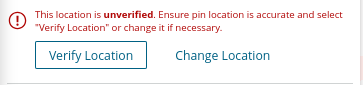
Regarding the "pins", I noticed the other day that I seem to have acquired the ability to click the "Verify Location" button on any member in the ward:jonesrk wrote: Mon Jan 20, 2025 11:51 am If you have current instances (moved in in the last 2 months) where the pins didn't moved with a move in feel free to PM me the details.